Drain-IQ™
your farm’s drainage map, pre-built and ready to use
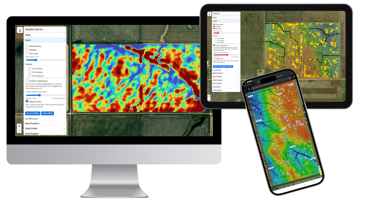
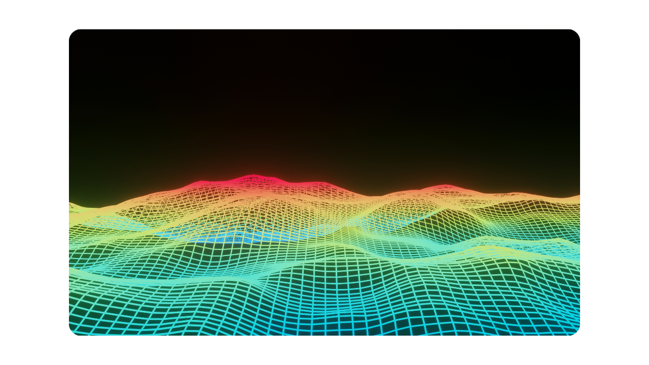
see every field’s flow, elevation, depressions, and contours in one simple online tool
The Smarter Way to Map Your Farm’s Elevation & Drainage
Starting at just $1/acre.
That’s not a typo. That’s the future.
How Drain‑IQ Works
Pay Once for Setup
We process your fields using our proprietary LiDAR and terrain modeling engine, then build your custom Drain‑IQ portal with every drainage layer ready to go.
Access Your Portal
You get a unique URL with all your fields, layers, and tools. Use it on any device—no software to install, no login needed. It’s fast, clean, and field‑ready.
Renew If You Want To
After your initial term (1–5 years), keep access for a small annual fee. No surprises. Just fast, always-on drainage mapping that keeps working.
Precision Mapping, Field‑Ready from Day One
Each Drain‑IQ field is expertly analyzed using advanced LiDAR and hydrological modeling—then optimized for instant access in your private web portal. Fast setup, no paper maps, no extra software.

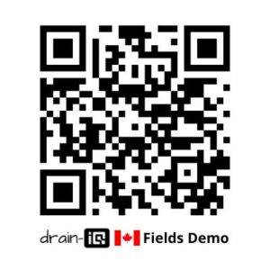
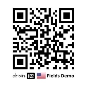
Try the Drain-IQ Demos
Explore randomly selected fields from across the western Canada and the US mid-west and see the full power of Drain-IQ in action. Your own farm’s version will look exactly the same — but with your fields, your unique URL, and your own QR code for instant access.
What You Can Do with Drain-IQ on Your Farm
Spot Highs & Lows in a Glance

Instantly view LiDAR-powered elevation maps with smart contours and elevation pins
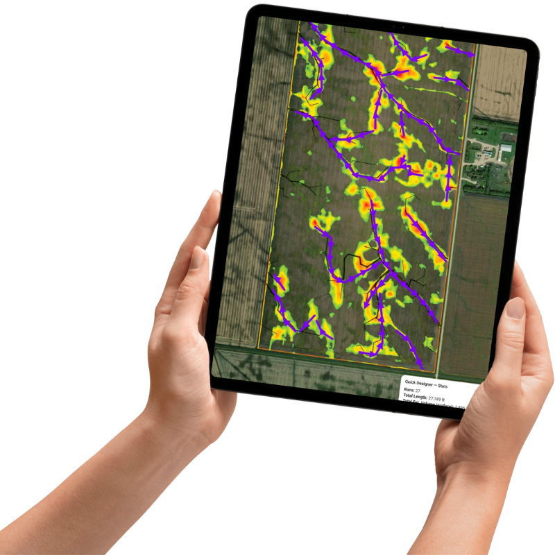
Trace Every Drain Path

Visualize where water naturally moves—and where to design your ditches or tile runs
Identify Ponding Risk Areas

See where the water will pond, even in a dry fall! Adjust thresholds and plan smarter tile or ditch placements
Target Wet Zones with Confidence

The wetness index layer identifies regions at risk of saturation, providing valuable insights for optimal tile placement
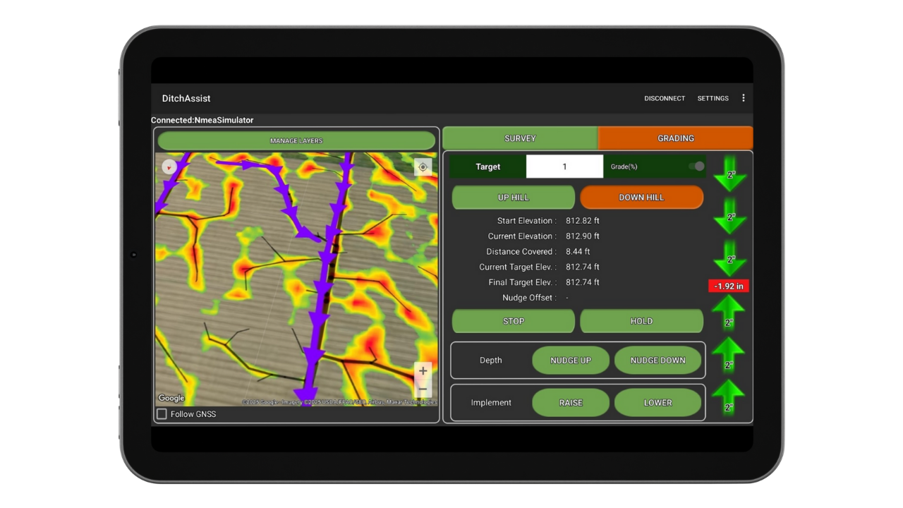
Create Drainage Designs and Export Overlays for Ditch Assist, SD Drain, Ditch Pro, and more
Use on Any Device, Online or Offline. Share your unique URL with whoever you need
Free Updates: If newer LiDAR becomes available in your area, we’ll rebuild your maps using the improved data—at no extra cost.
Quick Video Demos of Drain-IQ
Pick a Field
Toggle Layers
View Depressions & Ponding
Adjust Flow Intensity
Quickly Profile Drain Routes
Add Runs to Quick Designer
Build Field-Ready Drainage Plans
Drain-IQ Coverage Areas
Drain‑IQ covers all regions with public LiDAR data across Canada and the U.S. Whether you farm flat Red River Valley acres or rolling Iowa hills, if LiDAR exists—we can map it.
Use the following links to check latest coverage and confirm your area is covered before signing up.
Canada Coverage
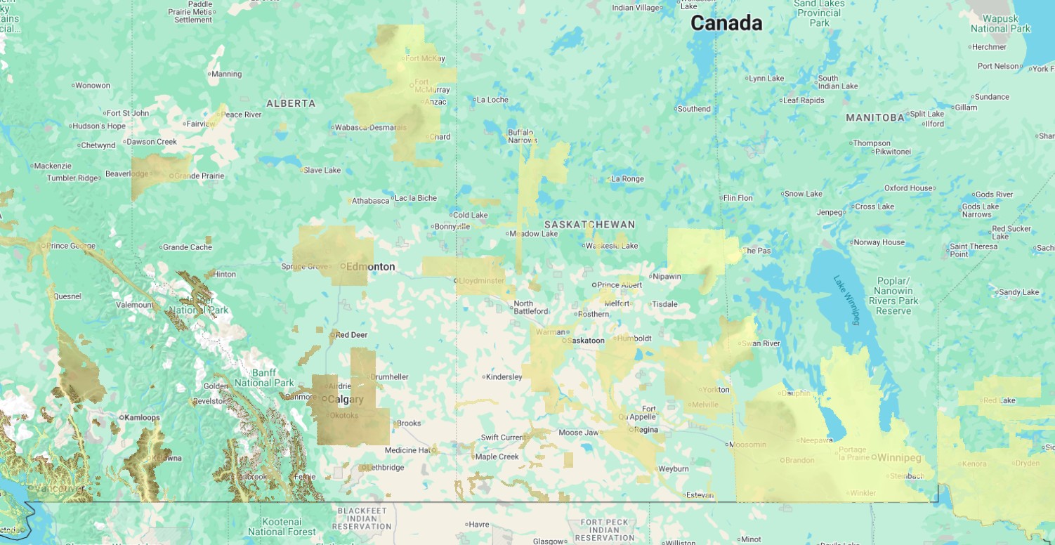
We can now map your fields virtually anywhere in southern Manitoba, and have expanding coverage into regions of Saskatchewan and Alberta. New LiDAR is added regularly so if you aren’t covered today, you may be in the near future. To see detailed latest coverage, click the button below:
United States Coverage
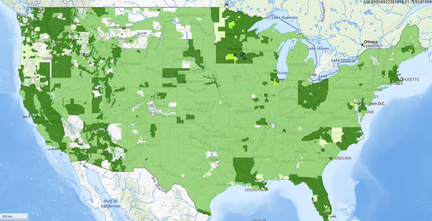
Almost all of the major US agricultural regions are now covered by LiDAR. Click on the button below to open the USGS LiDAR Viewer. Open the menu and check the box to ‘Show where LiDAR is available’ to see coverage and acquisition dates.
Simple Transparent Pricing
starting at $1/ac — pays for itself 10 to 40 times over
How Drain‑IQ Works
Pay Once for Setup
We process your fields using our proprietary LiDAR and terrain modeling engine, then build your custom Drain‑IQ portal with every drainage layer ready to go.
Access Your Portal
You get a unique URL with all your fields, layers, and tools. Use it on any device—no software to install, no login needed. It’s fast, clean, and field‑ready.
Renew If You Want To
After your initial term (1–5 years), keep access for a small annual fee. No surprises. Just fast, always-on drainage mapping that keeps working.
Built for whole-farm adoption
Drain-IQ is priced to make it easy for large operations to bring every field online—and fair for smaller farms too. Choose an initial commitment from 1–5 years; when your term ends, renew annually after initial term. If you already have field boundaries in Shapefile or KML, great—otherwise we can create them as a one-time service.
-
Large Farms (>1,000 total acres) get volume pricing across the entire operation.
-
Small Farms / Small Fields (≤1,000 total acres) get simple per-acre pricing with the same features.
No hidden fees. Your custom URL, hosting, and standard data exports are included in the per-acre price. All that’s required to get started are your field boundaries – if you don’t have any we can make them for you.
Estimate Your Price
Choose acres, fields, and an initial term (1–5 years). We detect your tier automatically. After your term, renew annually at the tier’s rate. If you don’t have Shapefile/KML boundaries, add the one-time boundary service.

Frequently Asked Questions
“This is exactly what we’ve been looking for on our farm. It’s simple but powerful, and gives us everything we need to make our drainage effective. The overlays for Ditch Assist are fantastic!”
– Real feedback from an early adopter

Simple by Design. No software to install. No logins.
Open your custom Drain-IQ link on any device and start planning in seconds. It’s field-ready and always up to date.